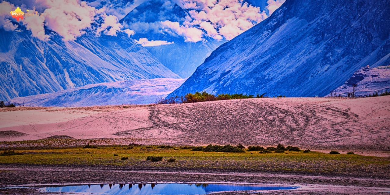
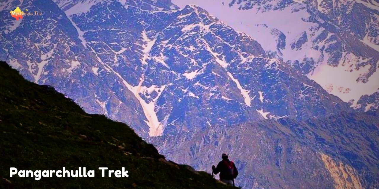
The Pangarchulla Trek is a popular trekking place in Uttarakhand. This trek is the best for both beginners and experienced trekkers. The height of this trek is 15,069 feet, and it is a 5-6 day trek. On the way, you will get to see beautiful views, lush green meadows, and snow-capped peaks.
The trek starts from Joshimath, and in between, you also cross the Kuari Pass. The summit of Pangarchulla may be a bit challenging, but the view you get after reaching the top makes it all worth it. The Pangarchulla temperature is cool during the season of the trek.
- Trek Height: 4481 m
- Trek Distance: 47 km
- Trek Difficulty Level: Hard
- Location: Uttarakhand
What is the best time for the Pangarchulla Trek?
The best time for the Pangarchulla Peak Trek is from the April to June or September to November. In April-May you get to see snow-covered trails and beautiful flowers. The weather is a little warm in June, but perfect for trekking. During monsoon season, in July-August, it should be avoided as the trails are slippery.
The weather is clear and cool in September-November, which is ideal for trekking. At this time you get clear views and good experience. Every season has different beauty and challenges, so you can plan according to your preferences.
Pangarchulla Trek Route:
The Pangarchulla trek route is something like this. On this route, you get beautiful views, diverse landscapes and adventurous experiences:
Joshimath:
The trek starts from Joshimath. This is a small town, and you can get ready for the trek by car.
Auli:
Drive from Joshimath to Auli. Auli is famous for skiing, and the trek starts here.
Gorson Bugyal:
You have reached Gorson Bugyal by trekking from Auli. This is a beautiful meadow where you can go camping.
Tali:
From Gorson Bugyal, you trek to Tali campsite. This place is also suitable for camping, and the views from here are amazing.
Khulara:
From Tali, you trek to Khulara campsite. Here, we camp at night and prepare for the next trek.
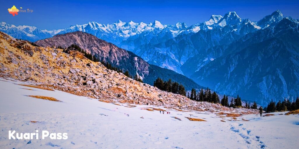
Kuari Pass:
By trekking from Khulara, you have crossed Kuari Pass. From here, you get panoramic views.
Pangarchulla Summit:
After crossing Kuari Pass, you reach the summit of Pangarchulla. This has been the most challenging part of the trek.
Return From Pangarchulla Trek:
After the summit, come back to Joshimath via the same route.
Pangarchulla Trek Weather: Monthly Weather Details:
Monthly Weather Details:
| Month | Temperature (Day) | Temperature (Night) |
| January | – 5°C to 5°C | -15°C to -5°C |
| February | – 5°C to 5°C | -15°C to -5°C |
| March | 0°C to 10°C | -10°C to 0°C |
| April | 5°C to 15°C | -5°C to 5°C |
| May | 10°C to 20°C | 0°C to 10°C |
| June | 10°C to 20°C | 5°C to 10°C |
| July | 15°C to 25°C | 10°C to 15°C |
| August | 15°C to 25°C | 10°C to 15°C |
| September | 10°C to 20°C | 5°C to 10°C |
| October | 5°C to 15°C | 0°C to 5°C |
| November | 0°C to 10°C | -5°C to 0°C |
| December | -5°C to 5°C | -15°C to -5°C |
About the Pangarchulla Bikat Packages:
| Package Detail | Information |
| Duration | 6 Days |
| Difficulty Level | Hard |
| Cost (Approx.) | 12,500 + 5% GST Add-ons: Rs. 1428 Backpack Offloading Rs. 248 Outdoor Insurance Rs. 1050 Single Tent Accommodation |
| Group Size | Max 15 |
| Location | Uttarakhand |
| Pangarchulla Peak Height | 15,069 feet |
FAQ’s:
The starting point of the Pangarchulla Trek is Joshimath, which is in Uttarakhand.
The duration of the Pangarchulla Trek is generally 5-6 days.